
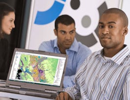
Apply your GIS knowledge in this course on geospatial analysis, focusing on analysis tools, 3D data, working with rasters, projections, and environment variables. Through all four weeks of this course, we'll work through a project together - something unique to this course - from project conception, through data retrieval, initial data management and processing, and finally to our analysis products.
Geospatial Analysis with ArcGIS
Geospatial Analysis with ArcGIS
This course is part of Geographic Information Systems (GIS) Specialization
Taught in English
Some content may not be translated

Instructor: Eric Howard
2,352 already enrolled
Included with 
Course
Gain insight into a topic and learn the fundamentals
4.4
(29 reviews)
Intermediate level
Recommended experience
12 hours (approximately)
Flexible schedule
Learn at your own pace
Skills you'll gain
Details to know

Shareable certificate
Add to your LinkedIn profile
Assessments
4 quizzes
Course
Gain insight into a topic and learn the fundamentals
4.4
(29 reviews)
Intermediate level
Recommended experience
12 hours (approximately)
Flexible schedule
Learn at your own pace
See how employees at top companies are mastering in-demand skills

Build your subject-matter expertise
This course is part of the Geographic Information Systems (GIS) Specialization
When you enroll in this course, you'll also be enrolled in this Specialization.
- Learn new concepts from industry experts
- Gain a foundational understanding of a subject or tool
- Develop job-relevant skills with hands-on projects
- Earn a shareable career certificate


Earn a career certificate
Add this credential to your LinkedIn profile, resume, or CV
Share it on social media and in your performance review

There are 4 modules in this course
After this module, you will be able to explain what geospatial analysis is and describe the geospatial analysis tool available for use in ArcGIS Pro formats, and the use cases for each. You will be able to demonstrate how to convert between different vector data types using ArcGIS Pro and describe what coordinate systems and projection systems are, and be able to compare and contrast different projection systems. You will compare and contrast different types of spatial relationships that can help answer "where" questions and demonstrate how to use the polygon neighbors tool to conduct an adjacency analysis. You'll be able to analyze the amount of overlap between spatial datasets using the select by location and summarize within tools in ArcGIS Pro, as well as analyze how near and far apart features are using the buffer and near tools in ArcGIS Pro. Finally, you'll be able to explain the process of creating a project proposal for a GIS-based project.
What's included
10 videos3 readings1 quiz3 discussion prompts
After this module, you will be able to describe what extensions are in ArcGIS Pro and recognize what additional geospatial analysis tools can be accessed using extensions. You will be able to differentiate what types of analyses can be run using the network analyst extension. You'll be able to create a network dataset and be able to explain the inputs required to run a network analysis. You will conduct a routing analysis using ArcGIS Pro and the Network Analyst extension and apply a routing-based service analysis to explore what features are accessible within a specified travel time.
What's included
6 videos1 reading1 quiz1 discussion prompt
After this module, you will be able to describe what interpolation is, and how it can be used in geospatial analysis. You will be able to demonstrate how to create raster surfaces from point data and describe what environmental variables are and how they can control the outputs of some spatial analysis tools. You'll be able to use the raster calculation and reclassification tools to prepare raster datasets for analysis and demonstrate how to use the zonal statistics tool to summarize raster datasets by specific geographic areas. You'll be able to describe pattern and clustering analysis methods available in ArcGIS Pro and use the spatial statistics tools to analyze spatial patterns. You will be able to apply the geographic distribution tools to understand the spatial shape and orientation of features and finally use the cluster analysis tools to identify and map clusters of features in ArcGIS Pro.
What's included
9 videos1 reading1 quiz1 discussion prompt
After this module, you will be able to describe how to make maps that support effect data storytelling and demonstrate how to create charts and graphs in ArcGIS Pro. You will be able to describe when it is appropriate to use a map, a table, or a chart. You will be able to describe what a StoryMap is and why it is a useful storytelling tool. Finally, you'll be able to demonstrate how to publish layers and maps from ArcGIS Pro to ArcGIS Online.
What's included
9 videos2 readings1 quiz3 discussion prompts
Instructor
Instructor ratings
3.7 (5 ratings)Offered by
Recommended if you're interested in Data Analysis
University of California, Davis
University of California, Davis

University of California, Davis
University of California, Davis
Why people choose Coursera for their career

Felipe M.
Learner since 2018
"To be able to take courses at my own pace and rhythm has been an amazing experience. I can learn whenever it fits my schedule and mood."

Jennifer J.
Learner since 2020
"I directly applied the concepts and skills I learned from my courses to an exciting new project at work."

Larry W.
Learner since 2021
"When I need courses on topics that my university doesn't offer, Coursera is one of the best places to go."

Chaitanya A.
"Learning isn't just about being better at your job: it's so much more than that. Coursera allows me to learn without limits."
Learner reviews
Showing 3 of 29
4.4
29 reviews
- 5 stars
65.51%
- 4 stars
20.68%
- 3 stars
6.89%
- 2 stars
3.44%
- 1 star
3.44%
New to Data Analysis? Start here.

Open new doors with Coursera Plus
Unlimited access to 7,000+ world-class courses, hands-on projects, and job-ready certificate programs - all included in your subscription
Advance your career with an online degree
Earn a degree from world-class universities - 100% online
Join over 3,400 global companies that choose Coursera for Business
Upskill your employees to excel in the digital economy
Frequently asked questions
Access to lectures and assignments depends on your type of enrollment. If you take a course in audit mode, you will be able to see most course materials for free. To access graded assignments and to earn a Certificate, you will need to purchase the Certificate experience, during or after your audit. If you don't see the audit option:
The course may not offer an audit option. You can try a Free Trial instead, or apply for Financial Aid.
The course may offer 'Full Course, No Certificate' instead. This option lets you see all course materials, submit required assessments, and get a final grade. This also means that you will not be able to purchase a Certificate experience.
When you enroll in the course, you get access to all of the courses in the Specialization, and you earn a certificate when you complete the work. Your electronic Certificate will be added to your Accomplishments page - from there, you can print your Certificate or add it to your LinkedIn profile. If you only want to read and view the course content, you can audit the course for free.
If you subscribed, you get a 7-day free trial during which you can cancel at no penalty. After that, we don’t give refunds, but you can cancel your subscription at any time. See our full refund policy.