
This course provides an overview of the most important digital applications in the field of aerospace research. The course instructors discuss how digitalisation is impacting and changing both satellite-based and manned spaceflight research. One unit is specifically devoted to exploring the use of artificial intelligence in the evaluation of satellite data.
Digitalisation in Space Research
Digitalisation in Space Research
This course is part of Digitalisation in Aeronautics and Space Specialization
Taught in English
Some content may not be translated


Instructors: Klaus Drechsler
4,287 already enrolled
Included with 
Course
Gain insight into a topic and learn the fundamentals
4.8
(88 reviews)
Intermediate level
Some related experience required
12 hours (approximately)
Flexible schedule
Learn at your own pace
What you'll learn
You will learn about a range of digital applications used in space research.
You will take a look at hazards created by digitalisation, especially in space travel, and at the challenges faced by the scientific community.
You will understand the effects of digitalisation on satellite navigation technology in particular.
Details to know

Shareable certificate
Add to your LinkedIn profile
Assessments
7 quizzes
Course
Gain insight into a topic and learn the fundamentals
4.8
(88 reviews)
Intermediate level
Some related experience required
12 hours (approximately)
Flexible schedule
Learn at your own pace
See how employees at top companies are mastering in-demand skills

Build your subject-matter expertise
This course is part of the Digitalisation in Aeronautics and Space Specialization
When you enroll in this course, you'll also be enrolled in this Specialization.
- Learn new concepts from industry experts
- Gain a foundational understanding of a subject or tool
- Develop job-relevant skills with hands-on projects
- Earn a shareable career certificate


Earn a career certificate
Add this credential to your LinkedIn profile, resume, or CV
Share it on social media and in your performance review

There are 4 modules in this course
Dr. Peter Weckesser provides insights into digitalisation processes from the manufacturing perspective, discussing approaches taken with the new digital workflows.
What's included
3 videos
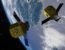
The digital revolution has an impact on many levels of space business and space technology. The advent of “New Space” is strongly connected to digitalisation, a game changer challenging long-standing paradigms such as in spacecraft mission and system design. This module illustrates the innovative effects of digitalisation in various areas such as earth observation, downstream services and mission and system design. The module also examines digitalisation challenges in the space sector including cyber threats and the sector’s increasing strategic and commercial value. - Lecturer: Professor Roger Förstner (Universität der Bundeswehr München).
What's included
5 videos1 reading2 quizzes2 peer reviews
Civil aviation is a multi-trillion-dollar market projected to grow continuously until at least 2040. Aircraft navigation and guidance from terminal to terminal is the determining cost factor for individual flights. Thus any savings resulting from the introduction of new digital technology will yield an extremely high return on investment due to economies of scale. This course outlines the specific navigation context before identifying where conventional navigation means (flight routes) are insufficient for achieving further increases in capacity, flexibility and performance. The concept of performance-based navigation (PBN) is outlined and why positioning needs to be available everywhere (area navigation - RNAV). The GNSS basic positioning principle is described and the relatively frequent satellite failures and anomalies are explored which are the reason why stand-alone GNSS cannot be used directly for a safety-critical application. The concept of solution separation statistics combined with the use of multiple GNSS constellations is introduced (Advanced Receiver Autonomous Integrity Monitoring – ARAIM) which in the long term may replace conventional navigation technology. The lecture concludes with a look at limiting factors, the current planning of civil aviation authorities and the European GNSS Galileo project. - Lecturer: Professor Thomas Pany (Universität der Bundeswehr München).
What's included
5 videos2 readings3 quizzes
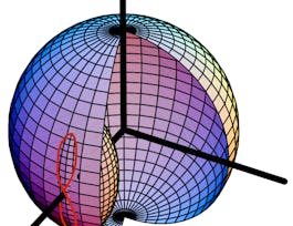
This online course is about the advances made in Earth Observation (EO) over the last few years. No other area of space applications has seen so much advancement in recent decades.The objective of this course is to explore the major trends in the collection, storage, distribution and analysis of remote sensing data. The complementary data sources introduced in the course include satellites, high-altitude platforms (HAPSs), planes and unmanned aerial vehicles (UAVs).The European Copernicus System is the world’s largest free and open monitoring system for environmental and security purposes. It is cited throughout the course as an example of the technological cutting edge, presented together with a commercial case study. Cloud-based access, archiving and processing technologies are introduced and discussed and basic terminology like DaaS, SaaS and PaaS is explained in the specific context of EO.The advent of Artificial Intelligence represents the dawn of a new era in data analysis. AI4EO provides additional analysis tools beyond physical algorithms. AI makes it possible to work on extremely big data volumes and combine very different data types such as images and social media data. - Lecturers: Professor Xiaoxiang Zhu (DLR German Aerospace Center & Technical University Munich) & Professor Volker Liebig (Airbus DS & University of Stuttgart).
What's included
6 videos1 reading2 quizzes
Instructors
Instructor ratings
4.7 (30 ratings)Offered by
Recommended if you're interested in Mechanical Engineering

Technical University of Munich (TUM)
University of Colorado Boulder
University of Colorado Boulder

Technical University of Munich (TUM)
Why people choose Coursera for their career

Felipe M.
Learner since 2018
"To be able to take courses at my own pace and rhythm has been an amazing experience. I can learn whenever it fits my schedule and mood."

Jennifer J.
Learner since 2020
"I directly applied the concepts and skills I learned from my courses to an exciting new project at work."

Larry W.
Learner since 2021
"When I need courses on topics that my university doesn't offer, Coursera is one of the best places to go."

Chaitanya A.
"Learning isn't just about being better at your job: it's so much more than that. Coursera allows me to learn without limits."
Learner reviews
Showing 3 of 88
4.8
88 reviews
- 5 stars
86.36%
- 4 stars
5.68%
- 3 stars
5.68%
- 2 stars
1.13%
- 1 star
1.13%

Open new doors with Coursera Plus
Unlimited access to 7,000+ world-class courses, hands-on projects, and job-ready certificate programs - all included in your subscription
Advance your career with an online degree
Earn a degree from world-class universities - 100% online
Join over 3,400 global companies that choose Coursera for Business
Upskill your employees to excel in the digital economy
Frequently asked questions
Access to lectures and assignments depends on your type of enrollment. If you take a course in audit mode, you will be able to see most course materials for free. To access graded assignments and to earn a Certificate, you will need to purchase the Certificate experience, during or after your audit. If you don't see the audit option:
The course may not offer an audit option. You can try a Free Trial instead, or apply for Financial Aid.
The course may offer 'Full Course, No Certificate' instead. This option lets you see all course materials, submit required assessments, and get a final grade. This also means that you will not be able to purchase a Certificate experience.
When you enroll in the course, you get access to all of the courses in the Specialization, and you earn a certificate when you complete the work. Your electronic Certificate will be added to your Accomplishments page - from there, you can print your Certificate or add it to your LinkedIn profile. If you only want to read and view the course content, you can audit the course for free.
If you subscribed, you get a 7-day free trial during which you can cancel at no penalty. After that, we don’t give refunds, but you can cancel your subscription at any time. See our full refund policy.